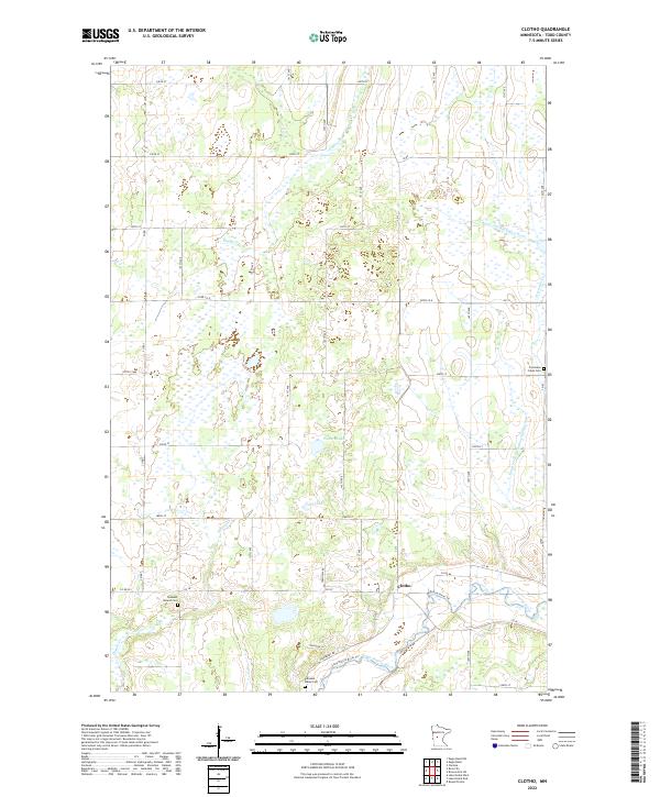
2022 Map of Clotho
USGS Topo · Published 2022About this map
The settlement of Clotho serves as a central point in this rural Todd County landscape, where the Long Prairie River and its associated Long Prairie River Trl cut through the southern townships. The terrain is defined by a complex network of wetlands and small water bodies, including Powers Lake and Gray Lake, which are integrated into an extensive drainage system featuring County Ditch Number Four and County Ditch Number Twenty-two. For local historians and genealogists, the map identifies three distinct burial grounds: Freemans Creek Cem, Pleasant Mound Cem, and Pleasant Valley Cem. The rural road grid, comprised of routes like Co RD 38 and 340th St, illustrates the persistent agricultural footprint of the region. Distinctive watercourses such as Eagle Cr and the aptly named Dismal Cr further characterize the hydrology of this central Minnesota territory.
Find a feature on this map
50 named features on this map. Tap any name to fly to it.
Don’t see what you’re looking for? This feature index may not catch every label — zoom into the map to look around manually.
Map Details
Editions of this 2022 Clotho Map
This is the sole edition of this map. No revisions or reprints were ever made.
Other maps of this area

1953 · Brainerd
USGS Topo · 1:250,000

1953 · Saint Cloud
USGS Topo · 1:250,000

1957 · Brainerd
USGS Topo · 1:250,000

1957 · Saint Cloud
USGS Topo · 1:250,000

1958 · Saint Cloud
USGS Topo · 1:250,000

1958 · Brainerd
USGS Topo · 1:250,000

1965 · Brainerd
USGS Topo · 1:250,000

1966 · Lake Osakis East
USGS Topo · 1:24,000
1966 · Clarissa
USGS Topo · 1:24,000
1966 · Browerville SW
USGS Topo · 1:24,000