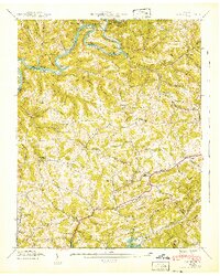
1942 Map of Clouds
USGS Topo · Published 1942About this map
Norris Reservoir and the Powell River dominate the landscape of the Tennessee Ridge and Valley province in the early 1940s. The region is defined by prominent topographical features such as Lonesome Valley and the towering Wallen Ridge, which dictate the placement of rural settlements and agricultural infrastructure. Small communities like Cline and Clouds are interconnected by a network of schools and churches, including Cline Sch and Moody Chapel, serving as local anchors.
Find a feature on this map
72 named features on this map. Tap any name to fly to it.
Don’t see what you’re looking for? This feature index may not catch every label — zoom into the map to look around manually.
Map Details
Editions of this 1942 Clouds Map
3 editions found
Other maps of this area

1886 · Cumberland Gap
USGS Topo · 1:125,000

1888 · Cumberland Gap
USGS Topo · 1:125,000

1891 · Cumberland Gap
USGS Topo · 1:125,000

1897 · Maynardville
USGS Topo · 1:125,000

1900 · Maynardville
USGS Topo · 1:125,000

1903 · Middlesboro
USGS Topo · 1:48,000

1927 · Middlesboro
USGS Topo · 1:62,500

1930 · Middlesboro
USGS Topo · 1:62,500

1935 · Mingo Mountains
USGS Topo · 1:24,000

1935 · Cumberland Gap
USGS Topo · 1:24,000