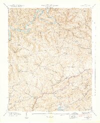
1942 Map of Clouds
USGS Topo · Published 1942About this map
Powell River winds through the heart of this landscape, its banks defined by the Norris Reservoir Boundary as the Tennessee Valley Authority reshaped the region's hydrology. The map captures a rural network of self-sustaining communities connected by the Southern railroad and narrow hollows. In Lonesome Valley and across Watson Ridge, the social fabric is visible through an exceptional concentration of family-named landmarks and local institutions, including Ford Chapel and the Locust Grove Sch. Industrial history is preserved at Cupp Mill and Meyers Mill, while unique geographic features like the Big Sink and the steep slopes of Wallen Ridge illustrate the complex karst topography of the Claiborne and Union county border. This record serves as a vital bridge for understanding the transition from traditional Appalachian farming life to the era of large-scale federal water management.
Find a feature on this map
76 named features on this map. Tap any name to fly to it.
Don’t see what you’re looking for? This feature index may not catch every label — zoom into the map to look around manually.
Map Details
Editions of this 1942 Clouds Map
3 editions found
Other maps of this area

1886 · Cumberland Gap
USGS Topo · 1:125,000

1888 · Cumberland Gap
USGS Topo · 1:125,000

1891 · Cumberland Gap
USGS Topo · 1:125,000

1897 · Maynardville
USGS Topo · 1:125,000

1900 · Maynardville
USGS Topo · 1:125,000

1903 · Middlesboro
USGS Topo · 1:48,000

1927 · Middlesboro
USGS Topo · 1:62,500

1930 · Middlesboro
USGS Topo · 1:62,500

1935 · Mingo Mountains
USGS Topo · 1:24,000

1935 · Cumberland Gap
USGS Topo · 1:24,000