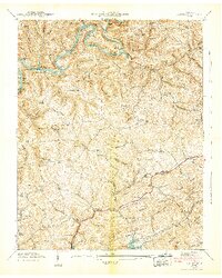
1942 Map of Clouds
USGS Topo · Published 1942About this map
Norris Reservoir and the Powell River define this 1941 landscape, where the Tennessee Valley Authority's influence meets the deeply established rural communities of Claiborne and Union counties. The terrain is characterized by a series of prominent ridges, including Killian Ridge and Wallen Ridge, with countless named hollows like Polecat Hollow and Hamlin Hollow sheltering small family farmsteads and local landmarks. This era shows a transition in local infrastructure, with traditional sites like Meyers Mill and Cupp Mill still noted alongside new reservation boundaries. Genealogists will find a wealth of local history in the numerous small burial grounds and schools scattered through the valleys, such as Ford Chapel Cem, Lily Grove Sch, and Locust Grove Sch. The intricate network of spring branches and creeks, including Straight Creek and Minton Creek, illustrates the traditional water-dependent settlement patterns of this Appalachian region before modern development fully transformed the river valley.
Find a feature on this map
94 named features on this map. Tap any name to fly to it.
Don’t see what you’re looking for? This feature index may not catch every label — zoom into the map to look around manually.
Map Details
Editions of this 1942 Clouds Map
3 editions found
Other maps of this area

1886 · Cumberland Gap
USGS Topo · 1:125,000

1888 · Cumberland Gap
USGS Topo · 1:125,000

1891 · Cumberland Gap
USGS Topo · 1:125,000

1897 · Maynardville
USGS Topo · 1:125,000

1900 · Maynardville
USGS Topo · 1:125,000

1903 · Middlesboro
USGS Topo · 1:48,000

1927 · Middlesboro
USGS Topo · 1:62,500

1930 · Middlesboro
USGS Topo · 1:62,500

1935 · Mingo Mountains
USGS Topo · 1:24,000

1935 · Cumberland Gap
USGS Topo · 1:24,000