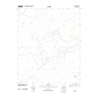
2009 Map of Cloudy
USGS Topo · Published 2009About this map
Cloudy Creek winds through this Pushmataha County landscape, providing the namesake for the local settlement and road network. The area is defined by a dense system of waterways, including Brushy Creek, Mill Creek, and West Dog Creek, which drain the varied elevation shown in these early 21st-century contours. Human activity is evidenced by the Cloudy Cemetery, a vital waypoint for genealogists researching families from this part of Oklahoma.
Find a feature on this map
24 named features on this map. Tap any name to fly to it.
Don’t see what you’re looking for? This feature index may not catch every label — zoom into the map to look around manually.
Map Details
Editions of this 2009 Cloudy Map
This is the sole edition of this map. No revisions or reprints were ever made.
Other maps of this area

1901 · Alikchi
USGS Topo · 1:125,000

1950 · Mcalester
USGS Topo · 1:250,000

1962 · McAlester
USGS Topo · 1:250,000

1962 · Sobol
USGS Topo · 1:24,000

1962 · Caney Mountain
USGS Topo · 1:24,000

1965 · McAlester
USGS Topo · 1:250,000

1971 · Spencerville
USGS Topo · 1:24,000
1971 · Rattan
USGS Topo · 1:24,000
1972 · Cloudy
USGS Topo · 1:24,000
1972 · Snow
USGS Topo · 1:24,000