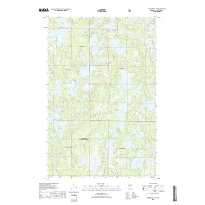
2019 Map of Clubhouse Lake
USGS Topo · Published 2019About this map
Chippewa National Forest surrounds an intricate network of waterways and glaciated terrain in this 2019 survey of Itasca County. The landscape is defined by its massive density of lakes, ranging from the sprawling Clubhouse Lake and Big Dick Lake in the north to the convoluted shoreline of Spider Lake in the south. The distribution of Co Hwy 45 and several forest roads like Burns Lake Rd and Gunn Lake Resort Rd suggests a region oriented toward seasonal recreation and timber management. High ground is represented by named landmarks such as Hill Lake, while the presence of Three Island Lake and Big Island Lake highlights the varied topography within these basins. This recent topographic record captures the area's modern drainage patterns and the precise boundaries of townships including t59n r25w and t58n r26w.
Find a feature on this map
94 named features on this map. Tap any name to fly to it.
Don’t see what you’re looking for? This feature index may not catch every label — zoom into the map to look around manually.
Map Details
Editions of this 2019 Clubhouse Lake Map
This is the sole edition of this map. No revisions or reprints were ever made.
Other maps of this area

1919 · Release
USGS Topo · 1:62,500

1919 · Marcell
USGS Topo · 1:62,500

1920 · Trout Lake
USGS Topo · 1:62,500

1943 · Release
USGS Topo · 1:62,500

1954 · Hibbing
USGS Topo · 1:250,000

1957 · Hibbing
USGS Topo · 1:250,000

1958 · Hibbing
USGS Topo · 1:250,000

1964 · Hibbing
USGS Topo · 1:250,000

1970 · Wabana Lake
USGS Topo · 1:24,000

1970 · Clubhouse Lake
USGS Topo · 1:24,000