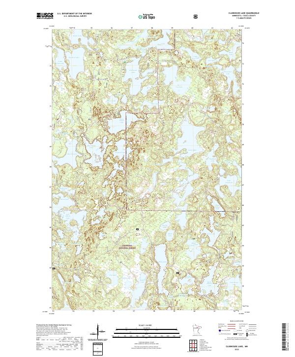
2022 Map of Clubhouse Lake
USGS Topo · Published 2022About this map
Chippewa National Forest encompasses the entirety of this lake-heavy terrain, where a dense network of forest roads and trails provides access to numerous glacial basins. The landscape is defined by its complex hydrography, featuring interconnected water bodies like Big Island Lake, Gunn Lake, and the namesake Clubhouse Lake. This modern survey reveals how the local geography is managed for both conservation and recreation, with established routes such as Gunn Lake Resort Rd and Spider Lake Access Rd leading to various shorelines.
Find a feature on this map
92 named features on this map. Tap any name to fly to it.
Don’t see what you’re looking for? This feature index may not catch every label — zoom into the map to look around manually.
Map Details
Editions of this 2022 Clubhouse Lake Map
This is the sole edition of this map. No revisions or reprints were ever made.
Other maps of this area

1919 · Release
USGS Topo · 1:62,500

1919 · Marcell
USGS Topo · 1:62,500

1920 · Trout Lake
USGS Topo · 1:62,500

1943 · Release
USGS Topo · 1:62,500

1954 · Hibbing
USGS Topo · 1:250,000

1957 · Hibbing
USGS Topo · 1:250,000

1958 · Hibbing
USGS Topo · 1:250,000

1964 · Hibbing
USGS Topo · 1:250,000

1970 · Wabana Lake
USGS Topo · 1:24,000

1970 · Clubhouse Lake
USGS Topo · 1:24,000