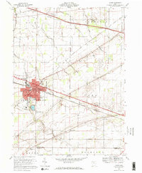
1969 Map of Clyde
USGS Topo · Published 1971About this map
Clyde anchors this northern Ohio landscape at a pivot point of mid-century industrial and transit development. The intersection of the Norfolk and Western Railroad and Penn Central lines defines the town's geography, supporting local infrastructure such as the sewage disposal plant and multiple oil sumps. Outside the urban core, the terrain transitions into a patchwork of rural townships, including Green Creek and York, where the Ohio Toll Road Turnpike cuts a modern path across the traditional agricultural grid.
Find a feature on this map
44 named features on this map. Tap any name to fly to it.
Don’t see what you’re looking for? This feature index may not catch every label — zoom into the map to look around manually.
Map Details
Editions of this 1969 Clyde Map
2 editions found
Other maps of this area

1901 · Bellevue
USGS Topo · 1:62,500

1901 · Fremont
USGS Topo · 1:62,500

1903 · Bellevue
USGS Topo · 1:62,500

1903 · Fremont
USGS Topo · 1:62,500

1906 · Tiffin
USGS Topo · 1:62,500

1915 · Siam
USGS Topo · 1:62,500

1956 · Toledo
USGS Topo · 1:250,000

1957 · Vickery
USGS Topo · 1:24,000
1957 · Wightmans Grove
USGS Topo · 1:24,000
1958 · Fremont East
USGS Topo · 1:24,000