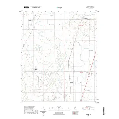
2020 Map of Coahoma
USGS Topo · Published 2020About this map
Coahoma and its surrounding Delta landscape are defined by an intricate network of slow-moving waterways and cypress brakes. The Big Sunflower River and Little Sunflower River wind through the western portion of the quadrangle, while smaller features like Buzzards Roost Brake and Corndike Brake mark the low-lying terrain. This area, traditionally agricultural, shows a dispersed settlement pattern with small communities like Armistead, Rudyard, and Clover Hill situated along the drainage divides and historical roadbeds.
Find a feature on this map
64 named features on this map. Tap any name to fly to it.
Don’t see what you’re looking for? This feature index may not catch every label — zoom into the map to look around manually.
Map Details
Editions of this 2020 Coahoma Map
This is the sole edition of this map. No revisions or reprints were ever made.
Other maps of this area

1908 · Lula
USGS Topo · 1:24,000

1908 · Coahoma
USGS Topo · 1:24,000

1908 · Moon Lake
USGS Topo · 1:24,000

1908 · Jonestown
USGS Topo · 1:24,000

1910 · Coahoma
USGS Topo · 1:31,680

1910 · Jonestown
USGS Topo · 1:31,680

1912 · Moon Lake
USGS Topo · 1:31,680

1912 · Lula
USGS Topo · 1:31,680

1932 · Tutwiler
USGS Topo · 1:48,000

1932 · Marks
USGS Topo · 1:48,000