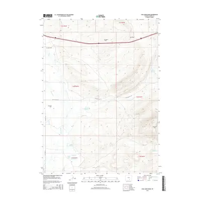
2015 Map of Coal Bank Basin
USGS Topo · Published 2015About this map
Coal Bank Basin and the adjacent Coal Bank Draw define this high-altitude landscape in Carbon County, Wyoming. The terrain is a complex network of ranching infrastructure and water management, centered around the Dana Ridge and the prominent Sheephead Mtn to the southeast. Water is channeled through an extensive system of man-made waterways, including the Vienna Ditch, Campbell Ditch, and Coyote Ditch, which feed various stock and fishing points.
Find a feature on this map
32 named features on this map. Tap any name to fly to it.
Don’t see what you’re looking for? This feature index may not catch every label — zoom into the map to look around manually.
Map Details
Editions of this 2015 Coal Bank Basin Map
This is the sole edition of this map. No revisions or reprints were ever made.
Other maps of this area

1893 · Fort Steele
USGS Topo · 1:125,000

1914 · Hanna
USGS Topo · 1:62,500

1914 · Walcott
USGS Topo · 1:62,500

1954 · Rawlins
USGS Topo · 1:250,000

1955 · Overland
USGS Topo · 1:24,000

1955 · Coal Bank Basin
USGS Topo · 1:24,000

1955 · Oberg Ranch
USGS Topo · 1:24,000

1955 · Meads
USGS Topo · 1:24,000

1955 · Rattlesnake Pass
USGS Topo · 1:24,000

1955 · Coad Mountain
USGS Topo · 1:24,000