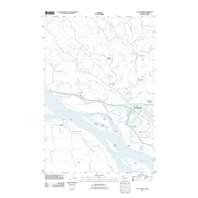
2011 Map of Coal Creek
USGS Topo · Published 2011About this map
Longview occupies the eastern portion of this Columbia River corridor, where the waterway creates a complex network of islands and channels between Washington and Oregon. The river's influence is evident in the dense concentration of named maritime and shoreline features like Fisher Island Channel, Walker Island, and Cleaveland Landing. Inland, the topography rises toward the Stella Range and Windy Ridge, carved by numerous drainages including Harmony Creek and Brock Creek.
Find a feature on this map
95 named features on this map. Tap any name to fly to it.
Don’t see what you’re looking for? This feature index may not catch every label — zoom into the map to look around manually.
Map Details
Editions of this 2011 Coal Creek Map
This is the sole edition of this map. No revisions or reprints were ever made.
Other maps of this area

1919 · Mayger
USGS Topo · 1:62,500

1921 · Kalama
USGS Topo · 1:62,500

1941 · Olequa
USGS Topo · 1:62,500

1941 · Clatskanie
USGS Topo · 1:62,500

1952 · Clatskanie
USGS Topo · 1:62,500

1953 · Hoquiam
USGS Topo · 1:250,000

1953 · Castle Rock
USGS Topo · 1:62,500

1953 · Ryderwood
USGS Topo · 1:62,500

1953 · Rainier
USGS Topo · 1:24,000
1953 · Kelso
USGS Topo · 1:24,000