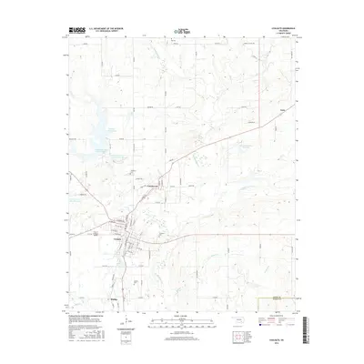
2016 Map of Coalgate
USGS Topo · Published 2016About this map
Coalgate serves as the central hub of this Coal County landscape, where the local economy and geography are defined by a complex network of reservoirs and creek systems. To the north and west of the city, a series of water management sites including the Coalgate Reservoir, Caney Coon Creek Site 2 Reservoir, and Caney-Coon Cr Site 3 Reservoir indicate a highly engineered hydrological environment designed to support the surrounding settlements. The terrain is marked by numerous family and community landmarks, such as Ott Cem and Woodman Cem, which provide essential touchpoints for genealogical research. Smaller communities like Cottonwood and Phillips sit in close proximity to the county seat, while the broader rural area is drained by Muddy Boggy Cr and Sulphur Cr. The presence of the City of Coalgate Airport west of the main town center highlights the regional infrastructure at the time of this survey.
Find a feature on this map
91 named features on this map. Tap any name to fly to it.
Don’t see what you’re looking for? This feature index may not catch every label — zoom into the map to look around manually.
Map Details
Editions of this 2016 Coalgate Map
This is the sole edition of this map. No revisions or reprints were ever made.
Other maps of this area

1896 · Coalgate
USGS Topo · 1:125,000

1899 · Coalgate
USGS Topo · 1:125,000

1899 · Atoka
USGS Topo · 1:125,000

1900 · Atoka
USGS Topo · 1:125,000

1900 · Coalgate
USGS Topo · 1:125,000

1956 · Stringtown
USGS Topo · 1:24,000

1957 · Coalgate
USGS Topo · 1:24,000

1957 · Lehigh
USGS Topo · 1:24,000

1957 · Coalgate SE
USGS Topo · 1:24,000

1957 · Centrahoma
USGS Topo · 1:24,000