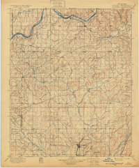
1900 Map of Coalgate
USGS Topo · Published 1932About this map
The Choctaw Nation and Chickasaw Nation territories intersect here along a complex boundary line as they appeared at the end of the nineteenth century. The settlement of Coalgate serves as a southern hub, supported by the Missouri Kansas and Texas R. R. and neighboring communities like Phillips and Cottonwood. In the north, the Canadian River provides a natural border for the Seminole Nation, with the Gulf Colorado and Santa Fe R. R. cutting through the landscape near Calvin and Stuart. This era represents a significant period of rail-driven expansion and tribal land administration before Oklahoma statehood. The terrain is defined by an extensive drainage system including Muddy Boggy Creek and Clear Boggy Creek, which flow through a region marked by landmarks like Limestone Ridge and the many small settlements such as Gerty, Allen, and Citra that dotted the landscape.
Find a feature on this map
81 named features on this map. Tap any name to fly to it.
Don’t see what you’re looking for? This feature index may not catch every label — zoom into the map to look around manually.
Map Details
Editions of this 1900 Coalgate Map
3 editions found
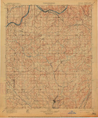
Other maps of this area

1896 · Seminole and Prague
USGS Topo · 1:125,000

1896 · Coalgate
USGS Topo · 1:125,000

1898 · McAlester
USGS Topo · 1:125,000

1899 · Coalgate
USGS Topo · 1:125,000

1899 · Atoka
USGS Topo · 1:125,000

1900 · Canadian
USGS Topo · 1:125,000

1900 · Wewoka
USGS Topo · 1:125,000

1900 · Atoka
USGS Topo · 1:125,000

1900 · Coalgate
USGS Topo · 1:125,000

1901 · Stonewall
USGS Topo · 1:125,000