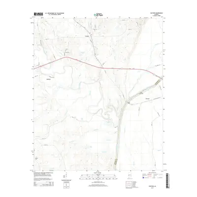
2014 Map of Coatopa
USGS Topo · Published 2014About this map
Coatopa sits near the confluence of the Sucarnochee River and Coatopa Cr in this rural West Alabama landscape. The terrain is defined by the winding hydrology of the Tombigbee River, which forms the boundary between Sumter and Marengo counties. Significant local landmarks include Rooster Bridge and the Indian Queen Bar, points where land travel met the river's edge. To the west, the community of Bellamy is reached via Hudson Valley Rd, while the Mt Tabor Cem stands as a point of interest for genealogists tracking local family histories near Mcgregor Lake. The map details a network of rural routes such as Lilita Rd and Freetown Rd, which weave through the drainage basins of Soctum Cr and Tallawyah Cr, illustrating the sparse but enduring settlement pattern of the Black Belt region.
Find a feature on this map
59 named features on this map. Tap any name to fly to it.
Don’t see what you’re looking for? This feature index may not catch every label — zoom into the map to look around manually.
Map Details
Editions of this 2014 Coatopa Map
This is the sole edition of this map. No revisions or reprints were ever made.
Other maps of this area

1929 · Epes
USGS Topo · 1:48,000

1932 · Epes
USGS Topo · 1:62,500

1948 · Mc Dowell
USGS Topo · 1:24,000

1949 · Mc Dowell
USGS Topo · 1:24,000

1953 · Montgomery
USGS Topo · 1:250,000

1953 · Meridian
USGS Topo · 1:250,000

1956 · Montgomery
USGS Topo · 1:250,000

1957 · Meridian
USGS Topo · 1:250,000

1957 · Montgomery
USGS Topo · 1:250,000

1965 · Meridian
USGS Topo · 1:250,000