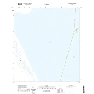
2021 Map of Cochrans Pass
USGS Topo · Published 2021About this map
Lake Okeechobee dominates this landscape, showing a vast expanse of open water and marshy transitions at the intersection of several Florida counties. In the southwestern corner, the map details complex aquatic features such as Moonshine Bay and the shallow waters of Observation Shoal. These areas represent the delicate balance of the lake's ecosystem, where the natural flow of water is captured in the eponymous Cochrans Pass. The map also functions as a jurisdictional reference, illustrating where the boundaries of Glades, Okeechobee, Martin, Hendry, and Palm Beach counties meet within the water. This 2021 edition provides a contemporary record of these hydrological landmarks as they exist in the early twenty-first century, useful for understanding the current state of South Florida's interior waterways.
Find a feature on this map
9 named features on this map. Tap any name to fly to it.
Don’t see what you’re looking for? This feature index may not catch every label — zoom into the map to look around manually.
Map Details
Editions of this 2021 Cochrans Pass Map
This is the sole edition of this map. No revisions or reprints were ever made.
Other maps of this area

1953 · Brighton SE
USGS Topo · 1:24,000

1953 · Okeechobee SW
USGS Topo · 1:24,000

1956 · West Palm Beach
USGS Topo · 1:250,000

1956 · Fort Pierce
USGS Topo · 1:250,000

1957 · West Palm Beach
USGS Topo · 1:250,000

1958 · Fort Pierce
USGS Topo · 1:250,000

1958 · West Palm Beach
USGS Topo · 1:250,000

1959 · Fort Pierce
USGS Topo · 1:250,000

1970 · Moore Haven
USGS Topo · 1:24,000
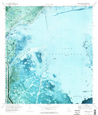
1971 · Fisheating Bay
USGS Topo · 1:24,000