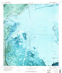
1971 Map of Fisheating Bay
USGS Topo · Published 1973About this map
Lakeport and the southern reaches of the Brighton Indian Reservation define the shoreline landscape along the western edge of Lake Okeechobee in the early 1970s. This orthophotomap provides a unique visual record of the complex water management systems and natural wetlands before further modern development. The engineered line of the Herbert Hoover Dyke creates a stark boundary between the open waters of Fisheating Bay and the terrestrial marshlands.
Find a feature on this map
24 named features on this map. Tap any name to fly to it.
Don’t see what you’re looking for? This feature index may not catch every label — zoom into the map to look around manually.
Map Details
Editions of this 1971 Fisheating Bay Map
2 editions found
Other maps of this area

1953 · Brighton SW
USGS Topo · 1:24,000

1953 · Brighton SE
USGS Topo · 1:24,000

1953 · Okeechobee SW
USGS Topo · 1:24,000

1956 · West Palm Beach
USGS Topo · 1:250,000

1956 · Fort Pierce
USGS Topo · 1:250,000

1957 · West Palm Beach
USGS Topo · 1:250,000

1958 · Fort Pierce
USGS Topo · 1:250,000

1958 · West Palm Beach
USGS Topo · 1:250,000

1959 · Fort Pierce
USGS Topo · 1:250,000

1970 · Moore Haven
USGS Topo · 1:24,000