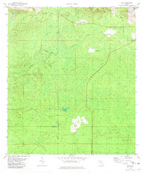
1981 Map of Cody
USGS Topo · Published 1981About this map
The St Marks River and its intricate drainage network define this 1981 survey of the borderlands between Jefferson, Leon, and Wakulla Counties. The small settlement of Cody sits in the northern section near a local Cem, while further south, Fanlew marks a clearing in the wooded terrain. This area of Florida is characterized by its karst topography, evidenced by distinctive hydrological features such as Florida Sink, Hardy Sink, and the slow-moving waters of Willow Swamp.
Find a feature on this map
19 named features on this map. Tap any name to fly to it.
Don’t see what you’re looking for? This feature index may not catch every label — zoom into the map to look around manually.
Map Details
Editions of this 1981 Cody Map
This is the sole edition of this map. No revisions or reprints were ever made.
Other maps of this area

1954 · Lloyd
USGS Topo · 1:24,000

1954 · Lafayette
USGS Topo · 1:24,000

1954 · Cody
USGS Topo · 1:24,000

1954 · Woodville
USGS Topo · 1:24,000

1954 · St. Marks NE
USGS Topo · 1:24,000

1954 · St. Marks
USGS Topo · 1:24,000

1954 · Valdosta
USGS Topo · 1:250,000

1954 · Tallahassee
USGS Topo · 1:250,000

1955 · Waukeenah
USGS Topo · 1:24,000

1955 · Nutall Rise
USGS Topo · 1:24,000