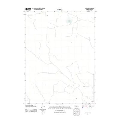
2011 Map of Cody Lake
USGS Topo · Published 2011About this map
Cody Lake sits as the central focal point of this Logan County landscape, surrounded by the characteristic ranching patterns of the Nebraska Sandhills. The area is defined by large-scale agricultural holdings and a network of winding local roads that connect family-operated lands. Established homesteads such as Lingner Ranch in the north and Viehmeyer Ranch further south indicate the long-standing ranching tradition of the region. Transportation across the undulating terrain is facilitated by unpaved routes including Kramer Rd and Jones Rd, which follow the natural contours of the land rather than a rigid grid. Further south, near the boundary of the survey, the Brosius Ranch and Kramer Ranch sit near Doyle Rd, marking the southern extent of this sparsely populated but active livestock-raising country.
Find a feature on this map
9 named features on this map. Tap any name to fly to it.
Don’t see what you’re looking for? This feature index may not catch every label — zoom into the map to look around manually.
Map Details
Editions of this 2011 Cody Lake Map
This is the sole edition of this map. No revisions or reprints were ever made.
Other maps of this area

1899 · North Platte
USGS Topo · 1:125,000

1902 · North Platte
USGS Topo · 1:125,000

1949 · Cody Lake
USGS Topo · 1:62,500

1951 · Cody Lake
USGS Topo · 1:62,500

1951 · Hoagland
USGS Topo · 1:62,500

1954 · North Platte
USGS Topo · 1:250,000

1956 · North Platte
USGS Topo · 1:250,000

1957 · North Platte
USGS Topo · 1:250,000

1967 · North Platte
USGS Topo · 1:250,000

1972 · Stapleton NW
USGS Topo · 1:24,000