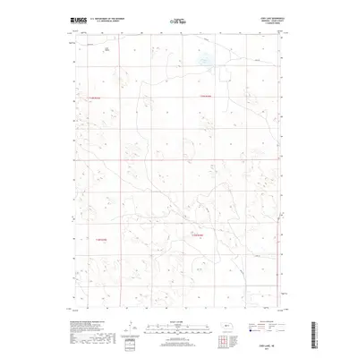
2017 Map of Cody Lake
USGS Topo · Published 2017About this map
Cody Lake sits as the central hydrologic feature in this portion of the Sandhills, surrounded by the undulating topography characteristic of Logan County. The area is defined by its sparse, rural character, with the settlement of Lone Valley located in the northwest corner, north of Kramer Rd. This landscape is primarily organized by its section-line roads and township boundaries, including t19n r28w and t18n r29w, which demarcate the vast stretches of open land. Transportation through this remote terrain relies on a network of unpaved routes such as Lanka Rd and Jones Rd, reflecting the enduring agricultural and ranching lifestyle of central Nebraska. The map illustrates how human activity, represented by isolated homesteads and local roads like Doyle Rd, integrates with the natural dune-and-lake environment of the region.
Find a feature on this map
10 named features on this map. Tap any name to fly to it.
Don’t see what you’re looking for? This feature index may not catch every label — zoom into the map to look around manually.
Map Details
Editions of this 2017 Cody Lake Map
This is the sole edition of this map. No revisions or reprints were ever made.
Other maps of this area

1899 · North Platte
USGS Topo · 1:125,000

1902 · North Platte
USGS Topo · 1:125,000

1949 · Cody Lake
USGS Topo · 1:62,500

1951 · Cody Lake
USGS Topo · 1:62,500

1951 · Hoagland
USGS Topo · 1:62,500

1954 · North Platte
USGS Topo · 1:250,000

1956 · North Platte
USGS Topo · 1:250,000

1957 · North Platte
USGS Topo · 1:250,000

1967 · North Platte
USGS Topo · 1:250,000

1972 · Stapleton NW
USGS Topo · 1:24,000