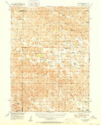
1951 Map of Cody Lake
USGS Topo · Published 1951About this map
Lone Valley and Green Valley dominate this mid-century Sandhills landscape, where the settlement pattern revolves almost entirely around family-operated cattle ranches and rural schoolhouses. Spanning the borders of Logan, McPherson, and Thomas Counties, the map reveals a highly decentralized community structure. Ranching names like Christian Ranch, Star Ranch, and L Barnum Ranch serve as primary landmarks across the rolling terrain. Educational hubs such as Cody Lake School and Prairie Dell School provided central gathering points for the isolated homesteads of the era. The presence of Cody Lake offers a notable water feature in an otherwise dry, basin-filled topography, while the Lone Star Cemetery provides a specific site for genealogical interest. This map captures the region's cattle-country character just as aerial photography began to modernize topographic mapping in the post-war period.
Find a feature on this map
36 named features on this map. Tap any name to fly to it.
Don’t see what you’re looking for? This feature index may not catch every label — zoom into the map to look around manually.
Map Details
Editions of this 1951 Cody Lake Map
2 editions found
Other maps of this area

1899 · North Platte
USGS Topo · 1:125,000

1902 · North Platte
USGS Topo · 1:125,000

1948 · Thedford
USGS Topo · 1:62,500

1948 · Halsey
USGS Topo · 1:62,500

1949 · Cody Lake
USGS Topo · 1:62,500

1950 · Thedford
USGS Topo · 1:62,500

1950 · Halsey
USGS Topo · 1:62,500

1950 · Shimmins Lake
USGS Topo · 1:62,500

1951 · Tryon
USGS Topo · 1:62,500

1951 · Cody Lake
USGS Topo · 1:62,500