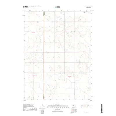
2017 Map of Cody Lake SW
USGS Topo · Published 2017About this map
Lone Valley dominates the northern reaches of this landscape, situated along the border of McPherson Co and Logan Co. This western Nebraska terrain is defined by the high tablelands of the Sandhills, where the elevation stays consistently above 3,100 feet. The sparse infrastructure of the region is centered on a few select corridors like Kramer Rd and Lariat Rd, which provide access through the rolling dune formations typical of this section of the state. The map captures the expansive, open character of the Nebraska interior, where early 21st-century land use is marked by large-scale township divisions like t19n r30w and t18n r29w, reflecting a history of cattle ranching and rural surveying in a largely unpopulated environment.
Find a feature on this map
8 named features on this map. Tap any name to fly to it.
Don’t see what you’re looking for? This feature index may not catch every label — zoom into the map to look around manually.
Map Details
Editions of this 2017 Cody Lake SW Map
This is the sole edition of this map. No revisions or reprints were ever made.
Other maps of this area

1899 · North Platte
USGS Topo · 1:125,000

1902 · North Platte
USGS Topo · 1:125,000

1949 · Cody Lake
USGS Topo · 1:62,500

1951 · Tryon
USGS Topo · 1:62,500

1951 · Cody Lake
USGS Topo · 1:62,500

1954 · North Platte
USGS Topo · 1:250,000

1956 · North Platte
USGS Topo · 1:250,000

1957 · North Platte
USGS Topo · 1:250,000

1967 · North Platte
USGS Topo · 1:250,000

1972 · Stapleton NW
USGS Topo · 1:24,000