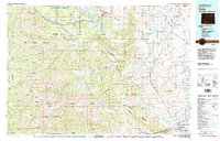
1980 Map of Cody
USGS Topo · Published 1995About this map
Cody serves as the focal point of this 1980s-era landscape, where the Shoshone National Forest meets the transition to the eastern plains. The mapping reveals a complex network of alpine features and low-lying basins, most notably the Beartooth Mountains and the Absaroka Mountains which dominate the western half of the quadrangle. The Clarks Fork Yellowstone River carves through the northern reaches, while the southern edge is anchored by the Shoshone River and the Buffalo Bill Reservoir.
Find a feature on this map
62 named features on this map. Tap any name to fly to it.
Don’t see what you’re looking for? This feature index may not catch every label — zoom into the map to look around manually.
Map Details
Editions of this 1980 Cody Map
3 editions found

Other maps of this area

1885 · Lake
USGS Topo · 1:125,000

1886 · Canyon
USGS Topo · 1:125,000

1891 · Livingston
USGS Topo · 1:250,000

1893 · Livingston
USGS Topo · 1:250,000

1893 · Ishawooa
USGS Topo · 1:125,000

1895 · Ishawooa
USGS Topo · 1:125,000

1895 · Canyon
USGS Topo · 1:125,000

1895 · Lake
USGS Topo · 1:125,000

1896 · Lake
USGS Topo · 1:125,000

1896 · Canyon
USGS Topo · 1:125,000