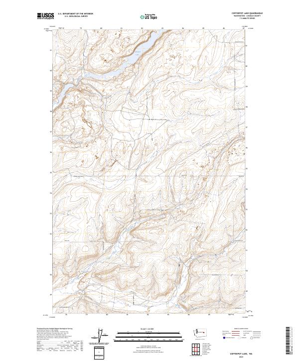
2023 Map of Coffeepot Lake
USGS Topo · Published 2023About this map
Coffeepot Lake and the surrounding drainage of the Channeled Scablands define this portion of Lincoln County. The landscape is marked by the hydrologic connection between Lake Creek and Duck Creek, with smaller water bodies like Deer Lake and Duck Lake punctuating the basin. This topography is characteristic of the region’s volcanic and glacial history, where coulees and seasonal springs like Coffeepot Spring once provided critical water sources in an otherwise arid environment.
Find a feature on this map
22 named features on this map. Tap any name to fly to it.
Don’t see what you’re looking for? This feature index may not catch every label — zoom into the map to look around manually.
Map Details
Editions of this 2023 Coffeepot Lake Map
This is the sole edition of this map. No revisions or reprints were ever made.
Other maps of this area

1953 · Ritzville
USGS Topo · 1:250,000

1959 · Ritzville
USGS Topo · 1:250,000

1965 · Ritzville
USGS Topo · 1:250,000

1968 · Sylvan Lake
USGS Topo · 1:24,000

1968 · Coffeepot Lake
USGS Topo · 1:24,000

1968 · Pacific Lake
USGS Topo · 1:24,000
1968 · Odessa
USGS Topo · 1:24,000

1969 · Rocklyn SW
USGS Topo · 1:24,000

1969 · Cormana Lake
USGS Topo · 1:24,000

1969 · Lamona
USGS Topo · 1:24,000