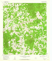
1960 Map of Coffeeville
USGS Topo · Published 1962About this map
Coffeeville and its surrounding rural communities are captured here during a period of transition in Northeast Texas, where old country roads meet a modern 4 Lane highway cutting through the wooded hills. The landscape is defined by its social anchors, particularly the numerous rural congregations such as Holly Springs Ch, Bishop Ch, and Prince Chapel. In the northeast, the terrain is marked by Coal Mine Hollow and Brown Mountain, hinting at the area's geological and industrial character. Local genealogy is anchored by the Coffeeville Cem, situated near the eponymous settlement. The drainage network, featuring South Greasy Creek and Gum Creek, dictates the placement of smaller hamlets like Cox and Stamps. This survey provides a clear view of the 1960s road network, contrasting established settlements with the topographic features of the Barnwell Mountains.
Find a feature on this map
26 named features on this map. Tap any name to fly to it.
Don’t see what you’re looking for? This feature index may not catch every label — zoom into the map to look around manually.
Map Details
Editions of this 1960 Coffeeville Map
2 editions found
Other maps of this area

1956 · Tyler
USGS Topo · 1:250,000

1960 · Bettie
USGS Topo · 1:24,000

1960 · Gilmer
USGS Topo · 1:24,000

1960 · Coffeeville
USGS Topo · 1:24,000

1960 · Glenwood
USGS Topo · 1:24,000

1960 · La Fayette
USGS Topo · 1:24,000

1960 · Pittsburg
USGS Topo · 1:24,000

1962 · Ashland
USGS Topo · 1:24,000

1962 · Ore City
USGS Topo · 1:24,000

1962 · Lone Star
USGS Topo · 1:24,000