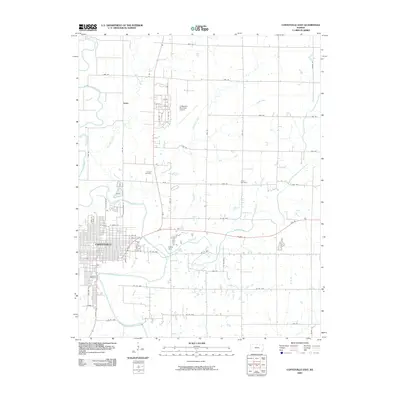
2009 Map of Coffeyville East
USGS Topo · Published 2009About this map
Coffeyville spreads across the southwest corner of this landscape, its grid of streets defined by thoroughfares like Sycamore St and Penn St just north of the Verdigris River. The surrounding terrain is a network of watercourses, including the convergence of Big Hill Creek and Claymore Creek as they flow toward the main river valley. To the north, the Coffeyville Municipal Airport and the small settlement of Avian sit among the section-line roads of the Kansas prairie.
Find a feature on this map
60 named features on this map. Tap any name to fly to it.
Don’t see what you’re looking for? This feature index may not catch every label — zoom into the map to look around manually.
Map Details
Editions of this 2009 Coffeyville East Map
This is the sole edition of this map. No revisions or reprints were ever made.
Other maps of this area

1886 · Independence
USGS Topo · 1:125,000

1886 · Parsons
USGS Topo · 1:125,000

1893 · Parsons
USGS Topo · 1:125,000

1894 · Independence
USGS Topo · 1:125,000

1901 · Nowata
USGS Topo · 1:125,000

1901 · Vinita
USGS Topo · 1:125,000

1905 · Independence
USGS Topo · 1:125,000

1913 · Vinita
USGS Topo · 1:125,000

1914 · Nowata
USGS Topo · 1:125,000

1946 · Mound Valley
USGS Topo · 1:62,500