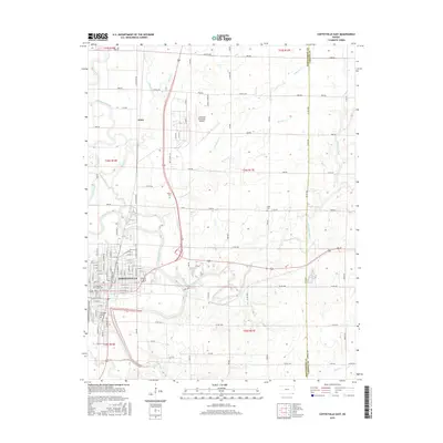
2016 Map of Coffeyville East
USGS Topo · Published 2016About this map
Coffeyville serves as the focal point of this 2016 survey, where the urban grid meets the agricultural landscape of southeastern Kansas. The city's academic and civic infrastructure is prominent, notably featuring the Coffeyville Community College campus and the sprawling Coffeyville Municipal Airport to the north. Waterways define the local topography, with the Verdigris River winding through the western portion of the quadrangle, joined by tributaries like Big Hill Creek, Potato Creek, and Claymore Creek.
Find a feature on this map
107 named features on this map. Tap any name to fly to it.
Don’t see what you’re looking for? This feature index may not catch every label — zoom into the map to look around manually.
Map Details
Editions of this 2016 Coffeyville East Map
This is the sole edition of this map. No revisions or reprints were ever made.
Other maps of this area

1886 · Independence
USGS Topo · 1:125,000

1886 · Parsons
USGS Topo · 1:125,000

1893 · Parsons
USGS Topo · 1:125,000

1894 · Independence
USGS Topo · 1:125,000

1901 · Nowata
USGS Topo · 1:125,000

1901 · Vinita
USGS Topo · 1:125,000

1905 · Independence
USGS Topo · 1:125,000

1913 · Vinita
USGS Topo · 1:125,000

1914 · Nowata
USGS Topo · 1:125,000

1946 · Mound Valley
USGS Topo · 1:62,500