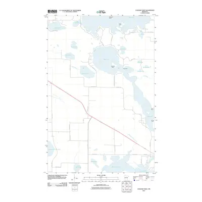
2010 Map of Cohasset West
USGS Topo · Published 2010About this map
The Mississippi River winds through the southern reaches of this landscape, connecting with a dense network of glacial lakes and wetlands in Itasca County. The central portion of the map is dominated by the sprawling waters of Bass Lake, which features several named landforms including Crawford Island and Hog Island. This area showcases a transitional terrain where large bodies of water like Blackwater Lake and Jay Gould Lake are interspersed with smaller, secluded basins such as Warburg Lake and Little Drum Lake.
Find a feature on this map
48 named features on this map. Tap any name to fly to it.
Don’t see what you’re looking for? This feature index may not catch every label — zoom into the map to look around manually.
Map Details
Editions of this 2010 Cohasset West Map
This is the sole edition of this map. No revisions or reprints were ever made.
Other maps of this area

1953 · Cohasset East
USGS Topo · 1:24,000

1953 · Siseebakwet Lake
USGS Topo · 1:24,000

1953 · Cohasset West
USGS Topo · 1:24,000

1953 · Grand Rapids
USGS Topo · 1:24,000

1954 · Hibbing
USGS Topo · 1:250,000

1957 · Hibbing
USGS Topo · 1:250,000

1958 · Hibbing
USGS Topo · 1:250,000

1964 · Hibbing
USGS Topo · 1:250,000

1970 · Deer River NE
USGS Topo · 1:24,000

1970 · Wabana Lake
USGS Topo · 1:24,000