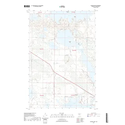
2019 Map of Cohasset West
USGS Topo · Published 2019About this map
Cohasset serves as the focal point of this region, situated where the Mississippi River flows through Blackwater Lake and into Jay Gould Lake. This landscape is defined by its complex hydrology, featuring numerous named islands such as Battleship Island and Picnic Island within Deer Lake, as well as Crawford Island and Hog Island in the central waters. The map illustrates a developed lakefront culture with many local routes like S Deer Circle Dr and Back-O-Moon Rd providing access to seasonal and permanent residences along Bass Lake and Lillian Lake. The industrial presence of Minnesota Power stands out near the river, signaling the modern energy infrastructure that characterizes the local economy. Throughout the quadrangle, the transition from open water to wetlands is marked by features like The Narrows and Fishhouse Bay, revealing the intricate shoreline of Itasca County.
Find a feature on this map
65 named features on this map. Tap any name to fly to it.
Don’t see what you’re looking for? This feature index may not catch every label — zoom into the map to look around manually.
Map Details
Editions of this 2019 Cohasset West Map
This is the sole edition of this map. No revisions or reprints were ever made.
Other maps of this area

1953 · Cohasset East
USGS Topo · 1:24,000

1953 · Siseebakwet Lake
USGS Topo · 1:24,000

1953 · Cohasset West
USGS Topo · 1:24,000

1953 · Grand Rapids
USGS Topo · 1:24,000

1954 · Hibbing
USGS Topo · 1:250,000

1957 · Hibbing
USGS Topo · 1:250,000

1958 · Hibbing
USGS Topo · 1:250,000

1964 · Hibbing
USGS Topo · 1:250,000

1970 · Deer River NE
USGS Topo · 1:24,000

1970 · Wabana Lake
USGS Topo · 1:24,000