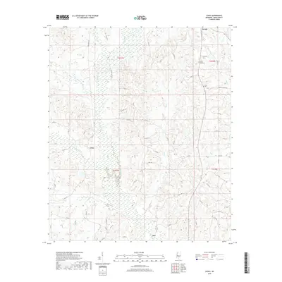
2018 Map of Cohay
USGS Topo · Published 2018About this map
Raleigh serves as a focal point in this 2018 survey of Smith County, where the terrain is defined by a dense network of tributaries including Hatchapaloo Cr and Ockohay Cr. The landscape transitions from the concentrated settlement at the northern edge to the winding watercourses of Fisher Cr and Cole Br. Evidence of local industry is seen along Raleigh Oil Field Rd, while the rural character of the area is anchored by the Union Baptist Church and its associated Church Cem. Small clusters of development at Cohay and the northern reaches of Mize illustrate the persistent rural settlement patterns of central Mississippi. Genealogists may find the location of the Tillson Cem and various county roads, such as Kendall Hancock Rd, useful for locating family land tracts and historical homesteads within the township and range system.
Find a feature on this map
60 named features on this map. Tap any name to fly to it.
Don’t see what you’re looking for? This feature index may not catch every label — zoom into the map to look around manually.
Map Details
Editions of this 2018 Cohay Map
This is the sole edition of this map. No revisions or reprints were ever made.
Other maps of this area

1935 · White Oak
USGS Topo · 1:24,000

1953 · Hattiesburg
USGS Topo · 1:250,000

1953 · Meridian
USGS Topo · 1:250,000

1957 · Meridian
USGS Topo · 1:250,000

1958 · Hattiesburg
USGS Topo · 1:250,000

1965 · Meridian
USGS Topo · 1:250,000

1968 · White Oak
USGS Topo · 1:24,000

1968 · Raleigh
USGS Topo · 1:24,000

1968 · Louin SW
USGS Topo · 1:24,000
1975 · Cohay
USGS Topo · 1:24,000