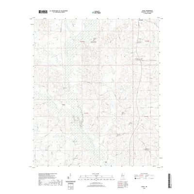
2020 Map of Cohay
USGS Topo · Published 2020About this map
The town of Raleigh sits at the northern edge of this Smith County landscape, where the headwaters of Fisher Cr and Beaver Cr begin their descent through the hills. This modern survey illustrates a community deeply rooted in its local institutions, evidenced by the dense network of rural churches and family burial grounds that dot the countryside. Significant sites include the Wilkinson Memorial Baptist Church Cem and the South Raleigh Christian Church Cem.
Find a feature on this map
73 named features on this map. Tap any name to fly to it.
Don’t see what you’re looking for? This feature index may not catch every label — zoom into the map to look around manually.
Map Details
Editions of this 2020 Cohay Map
This is the sole edition of this map. No revisions or reprints were ever made.
Other maps of this area

1935 · White Oak
USGS Topo · 1:24,000

1953 · Hattiesburg
USGS Topo · 1:250,000

1953 · Meridian
USGS Topo · 1:250,000

1957 · Meridian
USGS Topo · 1:250,000

1958 · Hattiesburg
USGS Topo · 1:250,000

1965 · Meridian
USGS Topo · 1:250,000

1968 · White Oak
USGS Topo · 1:24,000

1968 · Raleigh
USGS Topo · 1:24,000

1968 · Louin SW
USGS Topo · 1:24,000
1975 · Cohay
USGS Topo · 1:24,000