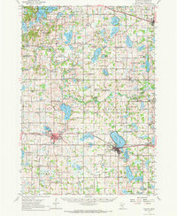
1958 Map of Cokato
USGS Topo · Published 1972About this map
Cokato serves as a primary hub of activity in this 1950s survey of Wright County, situated along the Burlington Northern railroad. The surrounding landscape is defined by its glacial lakes, including Cokato Lake, Lake Sylvia, and Howard Lake, which are bordered by numerous rural schoolhouses and ethnic churches. Significant local landmarks such as Norwegian Ch, Finnish Ch, and Our Saviour Ch reflect the Scandinavian heritage of the settlers who established these farming communities.
Find a feature on this map
120 named features on this map. Tap any name to fly to it.
Don’t see what you’re looking for? This feature index may not catch every label — zoom into the map to look around manually.
Map Details
Editions of this 1958 Cokato Map
2 editions found

Other maps of this area

1951 · Annandale
USGS Topo · 1:62,500

1953 · Saint Paul
USGS Topo · 1:250,000

1953 · New Ulm
USGS Topo · 1:250,000

1953 · Saint Cloud
USGS Topo · 1:250,000

1953 · Stillwater
USGS Topo · 1:250,000

1955 · Stillwater
USGS Topo · 1:250,000

1957 · Saint Cloud
USGS Topo · 1:250,000

1957 · New Ulm
USGS Topo · 1:250,000

1957 · Waconia
USGS Topo · 1:62,500

1958 · New Ulm
USGS Topo · 1:250,000