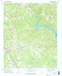
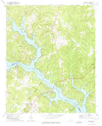
1971 Map of Cokesbury
USGS Topo · Published 1974About this map
Cokesbury serves as a historic center on this map, anchored by the Old Cokesbury College site. The landscape is defined by the convergence of agricultural land and the significant waters of Lake Greenwood, which occupies a large portion of the Saluda River valley. This 1970s survey captures the region as it maintained a dense network of rural community landmarks, including numerous small churches like New Zion Ch and Andrews Chapel. Transport and industry are marked by the presence of the Southern Seaboard Coast Line railroad and a quarry near Stony Point. Further south, infrastructure is represented by the County Airport and the County Prison Camp, while the Hodges Lookout Tower stands as a notable vertical landmark near the settlement of Hodges.
Find a feature on this map
34 named features on this map. Tap any name to fly to it.
Don’t see what you’re looking for? This feature index may not catch every label — zoom into the map to look around manually.
Map Details
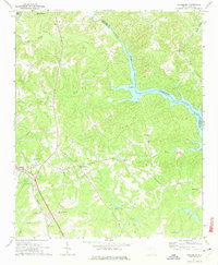
Editions of this 1971 Cokesbury Map
2 editions found
Other maps of this area

1892 · Abbeville
USGS Topo · 1:125,000

1948 · Abbeville East
USGS Topo · 1:24,000

1949 · Ninety-Six
USGS Topo · 1:24,000

1949 · Greenwood
USGS Topo · 1:24,000

1950 · Abbeville East
USGS Topo · 1:24,000

1954 · Greenville
USGS Topo · 1:250,000

1958 · Greenville
USGS Topo · 1:250,000
1971 · Ware Shoals East
USGS Topo · 1:24,000
1971 · Laurens South
USGS Topo · 1:24,000
1971 · Waterloo
USGS Topo · 1:24,000