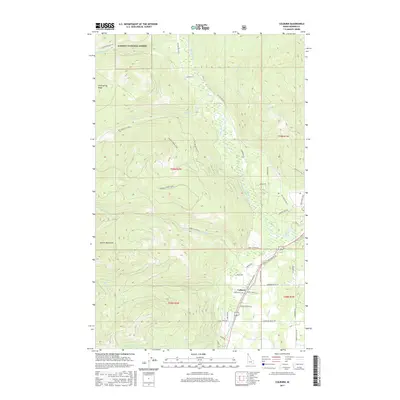
2017 Map of Colburn
USGS Topo · Published 2017About this map
The Colburn settlement sits at the heart of this North Idaho landscape, where the valley floor meets the rising timber of the Kaniksu National Forest. This 2017 survey details a transition from the lower elevations along Sand Cr and the Pack River to the high elevations of the Selkirk Mountains and Hellroaring Ridge in the west. The terrain is defined by a dense network of forest service roads and drainage systems, including Caribou Cr and French Cr.
Find a feature on this map
51 named features on this map. Tap any name to fly to it.
Don’t see what you’re looking for? This feature index may not catch every label — zoom into the map to look around manually.
Map Details
Editions of this 2017 Colburn Map
This is the sole edition of this map. No revisions or reprints were ever made.
Other maps of this area

1901 · Sandpoint
USGS Topo · 1:125,000

1911 · Priest Lake
USGS Topo · 1:250,000

1911 · Sandpoint
USGS Topo · 1:125,000

1913 · Priest Lake
USGS Topo · 1:250,000

1951 · Elmira
USGS Topo · 1:62,500

1958 · Sandpoint
USGS Topo · 1:250,000

1963 · Sandpoint
USGS Topo · 1:250,000

1965 · Naples
USGS Topo · 1:24,000

1967 · Mount Roothaan
USGS Topo · 1:24,000
1967 · Dodge Peak
USGS Topo · 1:24,000