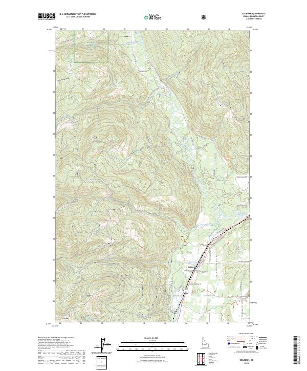
2024 Map of Colburn
USGS Topo · Published 2024About this map
The Colburn settlement sits within the Purcell Trench, a significant glacial valley where the mountain terrain gives way to a network of creeks and drainage basins. This area, largely defined by the Kaniksu National Forest, illustrates the intersection of timber-focused public land management and rural valley life. The hydrography is dense, with the Pack River and Sand Creek serving as primary arteries, fed by numerous tributaries including Hellroaring Creek, Caribou Creek, and French Creek. Navigation through the higher elevations like Hellroaring Ridge is facilitated by a system of forest development roads and specialized trails such as the French Creek A Ohv Trl. In the lower elevations, local lanes like Snowberry Ln and Fawn Gully Rd indicate a sparse but established residential pattern that clings to the fertile floor of the trench.
Find a feature on this map
54 named features on this map. Tap any name to fly to it.
Don’t see what you’re looking for? This feature index may not catch every label — zoom into the map to look around manually.
Map Details
Editions of this 2024 Colburn Map
This is the sole edition of this map. No revisions or reprints were ever made.
Other maps of this area

1901 · Sandpoint
USGS Topo · 1:125,000

1911 · Priest Lake
USGS Topo · 1:250,000

1911 · Sandpoint
USGS Topo · 1:125,000

1913 · Priest Lake
USGS Topo · 1:250,000

1951 · Elmira
USGS Topo · 1:62,500

1958 · Sandpoint
USGS Topo · 1:250,000

1963 · Sandpoint
USGS Topo · 1:250,000

1965 · Naples
USGS Topo · 1:24,000

1967 · Mount Roothaan
USGS Topo · 1:24,000
1967 · Dodge Peak
USGS Topo · 1:24,000