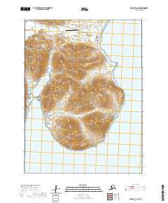
2020 Map of Cold Bay A-1 SW
USGS Topo · Published 2020About this map
King Cove sits at the head of a narrow inlet on the Alaska Peninsula, where the local economy and transportation network converge at the edge of the Pacific Ocean. This modern topographic survey highlights a landscape dominated by coastal navigation and aviation, anchored by the King Cove Airport and a series of specialized routes like Boat Harbor Road and Dennis Gould Road. The town's layout is closely tied to its geography, with development pressed between the steep terrain and the sheltered King Cove Lagoon. Notable landmarks for family history include the King Cove Cem and various named coastal points such as Indian Head and Slavna Point. The map also details the rugged southern coastline near Bold Cape, where the land meets Deer Passage, illustrating the critical relationship between the settlement and its maritime environment.
Find a feature on this map
26 named features on this map. Tap any name to fly to it.
Don’t see what you’re looking for? This feature index may not catch every label — zoom into the map to look around manually.
Map Details
Editions of this 2020 Cold Bay A-1 SW Map
This is the sole edition of this map. No revisions or reprints were ever made.
Other maps of this area

1943 · Fort Randall
USGS Topo · 1:250,000

1949 · False Pass
USGS Topo · 1:250,000

1949 · Fort Randall
USGS Topo · 1:250,000

1950 · False Pass
USGS Topo · 1:250,000

1950 · Fort Randall
USGS Topo · 1:250,000

1963 · False Pass D-1
USGS Topo · 1:63,360

1963 · False Pass D-2
USGS Topo · 1:63,360
1983 · Cold Bay A-1
USGS Topo · 1:63,360
1995 · Cold Bay A-2
USGS Topo · 1:63,360
2020 · False Pass D-1 NW
USGS Topo · 1:25,000