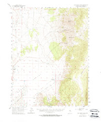
1957 Map of Cold Creek Ranch
USGS Topo · Published 1967About this map
The Elko-Hamilton Stage Route cuts across the high basins of White Pine County, tracing a path through the arid flats and rugged ranges of eastern Nevada. This 1957 survey illustrates the enduring importance of water and transit in a landscape dominated by the Newark Valley and Huntington Valley. Settlement is centered on remote outposts like Cold Creek Ranch and Warm Springs Ranch, where natural springs provided essential life for livestock and travelers alike.
Find a feature on this map
31 named features on this map. Tap any name to fly to it.
Don’t see what you’re looking for? This feature index may not catch every label — zoom into the map to look around manually.
Map Details
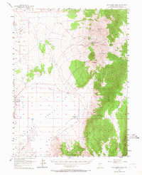
Editions of this 1957 Cold Creek Ranch Map
3 editions found
Other maps of this area

1934 · Jiggs
USGS Topo · 1:125,000

1937 · Jiggs
USGS Topo · 1:125,000

1953 · Eureka
USGS Topo · 1:62,500

1955 · Elko
USGS Topo · 1:250,000

1956 · Ely
USGS Topo · 1:250,000

1957 · Buck Mountain
USGS Topo · 1:62,500

1957 · Diamond Springs
USGS Topo · 1:62,500

1957 · Cold Creek Ranch
USGS Topo · 1:62,500

1958 · Elko
USGS Topo · 1:250,000

1959 · Ely
USGS Topo · 1:250,000