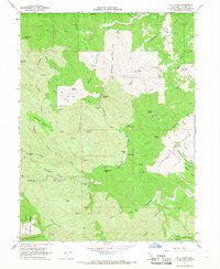
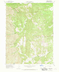
1967 Map of Cold Fork
USGS Topo · Published 1968About this map
Trinity National Forest occupies the southwestern corner of this 1960s landscape, where the terrain transitions from steep ridges to a series of high mountain flats. The settlement pattern here is defined by isolated homesteads and specific landmarks like Alford Place, Haven Place, and the Skinner Mill Place along the South Fork of Cottonwood Creek. A notable concentration of human activity is found near Schoolhouse Flat and Oak Flat, the latter containing a label for Graves, indicating early family burials or remote homestead sites.
Find a feature on this map
86 named features on this map. Tap any name to fly to it.
Don’t see what you’re looking for? This feature index may not catch every label — zoom into the map to look around manually.
Map Details
Editions of this 1967 Cold Fork Map
3 editions found
Other maps of this area

1890 · Red Bluff
USGS Topo · 1:250,000

1894 · Red Bluff
USGS Topo · 1:250,000

1949 · Colyear Springs
USGS Topo · 1:62,500

1951 · Chanchelulla Peak
USGS Topo · 1:62,500

1952 · Ono
USGS Topo · 1:62,500

1954 · Yolla Bolly
USGS Topo · 1:62,500

1957 · Colyear Springs
USGS Topo · 1:62,500

1958 · Redding
USGS Topo · 1:250,000
1967 · Oxbow Bridge
USGS Topo · 1:24,000
1967 · Lowrey
USGS Topo · 1:24,000