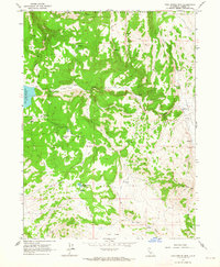
1962 Map of Cold Spring Mtn
USGS Topo · Published 1964About this map
Modoc National Forest encompasses the high-elevation terrain of this 1962 survey, where the boundary between Modoc and Lassen counties bisects a landscape defined by seasonal water management and ranching outposts. The western edge is dominated by the Tule Lake Reservoir, while the interior features isolated structures like the Christensen Corral and Hall Cabin, marking the human imprint on this remote timber and grazing land.
Find a feature on this map
21 named features on this map. Tap any name to fly to it.
Don’t see what you’re looking for? This feature index may not catch every label — zoom into the map to look around manually.
Map Details
Editions of this 1962 Cold Spring Mtn Map
4 editions found
Other maps of this area

1886 · Alturas
USGS Topo · 1:250,000

1886 · Honey Lake
USGS Topo · 1:250,000

1891 · Honey Lake
USGS Topo · 1:250,000

1892 · Alturas
USGS Topo · 1:250,000

1893 · Honey Lake
USGS Topo · 1:250,000

1954 · Observation Peak
USGS Topo · 1:62,500

1954 · Ravendale
USGS Topo · 1:62,500

1954 · Alturas
USGS Topo · 1:250,000

1955 · Westwood
USGS Topo · 1:250,000

1958 · Alturas
USGS Topo · 1:250,000