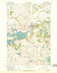
1967 Map of Cold Spring
USGS Topo · Published 1969About this map
The Sauk River winds through the heart of this central Minnesota landscape, anchoring the city of Cold Spring and its surrounding rural townships. In the late 1960s, the area's geography is defined by a dense concentration of glacial lakes, including Great Northern Lake, Cedar Island Lake, and Knaus Lake, which collectively form a complex waterway south of the river. The Great Northern railroad tracks parallel the river, reflecting the historical transport corridor that supported the local granite quarrying and agricultural economy.
Find a feature on this map
37 named features on this map. Tap any name to fly to it.
Don’t see what you’re looking for? This feature index may not catch every label — zoom into the map to look around manually.
Map Details
Editions of this 1967 Cold Spring Map
2 editions found
Other maps of this area

1953 · Saint Cloud
USGS Topo · 1:250,000

1957 · Saint Cloud
USGS Topo · 1:250,000

1958 · Saint Cloud
USGS Topo · 1:250,000

1965 · Farming
USGS Topo · 1:24,000

1965 · St Joseph
USGS Topo · 1:24,000

1965 · Avon
USGS Topo · 1:24,000

1967 · Cold Spring
USGS Topo · 1:24,000

1967 · Richmond
USGS Topo · 1:24,000

1967 · Watkins
USGS Topo · 1:24,000

1967 · Rockville
USGS Topo · 1:24,000