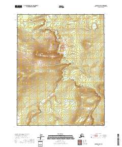
2018 Map of Coleen A-2 SW
USGS Topo · Published 2018About this map
David Cr and Rat Cr define the hydrological character of this portion of the Coleen River drainage. This 2018 survey reveals a terrain defined by subtle elevation changes and the absence of human infrastructure, consistent with the remote interior of the Yukon-Koyukuk Census Area. The topography is meticulously captured by the U.S. Geological Survey using modern National Elevation Dataset information, showing the complex drainage patterns where David Cr flows through the central and southern sections of the quadrangle. The map is primarily an exercise in topographic precision, illustrating the natural landforms of the Porcupine River region before any significant development or road networks were established.
Find a feature on this map
8 named features on this map. Tap any name to fly to it.
Don’t see what you’re looking for? This feature index may not catch every label — zoom into the map to look around manually.
Map Details
Editions of this 2018 Coleen A-2 SW Map
This is the sole edition of this map. No revisions or reprints were ever made.
Other maps of this area

1951 · Black River
USGS Topo · 1:250,000

1951 · Coleen
USGS Topo · 1:250,000

1956 · Coleen
USGS Topo · 1:250,000

1956 · Black River D-3
USGS Topo · 1:63,360

1956 · Coleen A-3
USGS Topo · 1:63,360

1956 · Black River D-2
USGS Topo · 1:63,360

1956 · Coleen A-2
USGS Topo · 1:63,360

1956 · Black River
USGS Topo · 1:250,000

1964 · Black River
USGS Topo · 1:250,000
2018 · Coleen A-2 SE
USGS Topo · 1:25,000