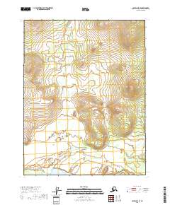
2018 Map of Coleen A-5 SE
USGS Topo · Published 2018About this map
Deacons Rock stands as a prominent landmark in this 2018 topographic study of the region surrounding Plaza Huincul. The map details the expansive arid terrain of the Neuquén Basin, a territory defined by its significant role in Argentina's energy history since the first oil discovery at Pozo N° 1 in 1918. While the landscape is characterized by its vast open spaces and sparse vegetation typical of the Patagonian steppe, the cartography meticulously records the section lines of various townships, including t27n r21e, t26n r21e, and t25n r21e. These surveyed grids reflect the organized industrial and agricultural development that has shaped the area. Geologists and historians can trace the relationship between the natural topography and the human-imposed boundaries that manage the region's vital natural resources.
Find a feature on this map
8 named features on this map. Tap any name to fly to it.
Don’t see what you’re looking for? This feature index may not catch every label — zoom into the map to look around manually.
Map Details
Editions of this 2018 Coleen A-5 SE Map
This is the sole edition of this map. No revisions or reprints were ever made.
Other maps of this area

1951 · Black River
USGS Topo · 1:250,000

1951 · Coleen
USGS Topo · 1:250,000

1956 · Coleen
USGS Topo · 1:250,000

1956 · Coleen A-5
USGS Topo · 1:63,360

1956 · Black River D-4
USGS Topo · 1:63,360

1956 · Black River D-5
USGS Topo · 1:63,360

1956 · Coleen A-4
USGS Topo · 1:63,360

1956 · Black River
USGS Topo · 1:250,000

1964 · Black River
USGS Topo · 1:250,000
2018 · Coleen A-5 SW
USGS Topo · 1:25,000