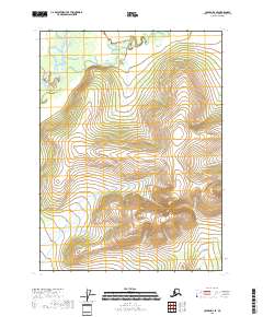
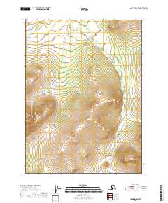
2018 Map of Coleen D-3 SE
USGS Topo · Published 2018About this map
Coleen River meanders through the northern reaches of this landscape, its path defined by the intricate oxbows and seasonal channels characteristic of the Arctic interior. The waterway is joined by Strangle Woman Creek, which flows from the southwest to meet the river's wider basin. This 2018 survey reveals a terrain dominated by significant elevation changes, with the southern portion of the sheet rising steadily toward unnamed peaks while the northern flats are dominated by the hydraulic patterns of the river system. In the southeastern corner, the headwaters of Dorothy Cr emerge from the high ground, marking the divide between local drainages. The absence of roads or established settlements underscores the wild, untouched character of this portion of the Yukon-Koyukuk Census Area, where the landscape remains shaped primarily by the seasonal flow of its glacial and snow-fed waters.
Find a feature on this map
7 named features on this map. Tap any name to fly to it.
Don’t see what you’re looking for? This feature index may not catch every label — zoom into the map to look around manually.
Map Details
Editions of this 2018 Coleen D-3 SE Map
This is the sole edition of this map. No revisions or reprints were ever made.
Other maps of this area

1951 · Coleen
USGS Topo · 1:250,000

1956 · Coleen
USGS Topo · 1:250,000
1972 · Coleen D-2
USGS Topo · 1:63,360
1972 · Coleen D-3
USGS Topo · 1:63,360
1990 · Coleen C-2
USGS Topo · 1:63,360
1990 · Coleen C-3
USGS Topo · 1:63,360
2018 · Coleen D-3 NE
USGS Topo · 1:25,000
2018 · Coleen D-3 SW
USGS Topo · 1:25,000
2018 · Coleen D-3 NW
USGS Topo · 1:25,000
2018 · Coleen D-2 SW
USGS Topo · 1:25,000