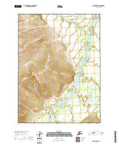
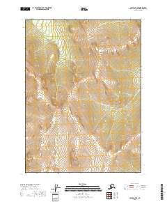
2018 Map of Coleen D-5 NW
USGS Topo · Published 2018About this map
The Sheenjek River dominates this remote landscape within the Yukon-Koyukuk Census Area, shown here as it appeared in 2018. The river's braided channel system creates a complex network of shifting gravel bars and seasonal waterways, a characteristic of the high-latitude hydrological systems in northern Alaska. While the river itself is the primary navigational corridor, Monument Creek enters from the west, feeding into the wider basin. The topography is defined by significant elevation changes, with the eastern half of the map showing the river's broad floodplain while the western portions rise into unnamed ridge systems. This survey documents the untouched natural state of the region, where no roads or permanent human settlements are recorded, emphasizing the wilderness character of the Sheenjek River valley.
Find a feature on this map
8 named features on this map. Tap any name to fly to it.
Don’t see what you’re looking for? This feature index may not catch every label — zoom into the map to look around manually.
Map Details
Editions of this 2018 Coleen D-5 NW Map
This is the sole edition of this map. No revisions or reprints were ever made.
Other maps of this area

1951 · Coleen
USGS Topo · 1:250,000

1951 · Table Mountain
USGS Topo · 1:250,000

1956 · Table Mountain
USGS Topo · 1:250,000

1956 · Coleen
USGS Topo · 1:250,000

1964 · Table Mountain
USGS Topo · 1:250,000
1972 · Coleen D-5
USGS Topo · 1:63,360
1972 · Table Mountain A-5
USGS Topo · 1:63,360
1972 · Table Mountain A-4
USGS Topo · 1:63,360

1972 · Coleen D-6
USGS Topo · 1:63,360
2018 · Coleen D-5 SE
USGS Topo · 1:25,000