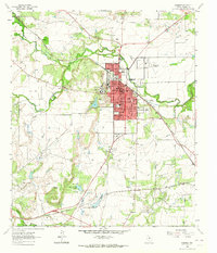
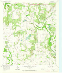
1963 Map of Coleman
USGS Topo · Published 1964About this map
Coleman serves as the focal point of this Central Texas landscape, organized around a dense grid of streets like College Avenue and Highway Street. The town's civic infrastructure is well-defined, featuring the Courthouse, Hospital, and a dedicated Fairground near the city center. Educational hubs like West Ward School and Jr High School anchor the residential blocks, reflecting the town's mid-century community layout. Outside the urban core, the terrain is shaped by a network of waterways including Hords Creek and Loss Creek, with Old City Lake providing a significant local reservoir. The Gulf Colorado and Santa Fe railroad cuts a diagonal path through the area, highlighting the era's reliance on rail transport for moving goods across the ranching and agricultural plains. Rural life is further evidenced by landmarks such as Shiloh Church and several small water bodies like Country Club Lake.
Find a feature on this map
34 named features on this map. Tap any name to fly to it.
Don’t see what you’re looking for? This feature index may not catch every label — zoom into the map to look around manually.
Map Details
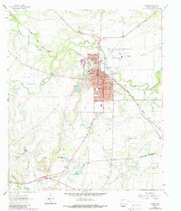
Editions of this 1963 Coleman Map
2 editions found
Other maps of this area

1887 · Coleman
USGS Topo · 1:125,000

1889 · Coleman
USGS Topo · 1:125,000

1892 · Ballinger
USGS Topo · 1:125,000

1932 · Voss
USGS Topo · 1:62,500

1954 · Brownwood
USGS Topo · 1:250,000

1960 · Lake Scarborough
USGS Topo · 1:24,000
1960 · Coleman NE
USGS Topo · 1:24,000

1962 · Santa Anna
USGS Topo · 1:24,000
1963 · Lake San Tana
USGS Topo · 1:24,000
1964 · Fisk
USGS Topo · 1:24,000