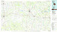
1985 Map of Coleman
USGS Topo · Published 1985About this map
Coleman and the surrounding ranching country of Central Texas are defined by the convergence of several major waterways and the path of the Atchison Topeka and Santa Fe railroad in the mid-1980s. The terrain transitions from the Holloway Mountains in the northeast to the broad valleys formed by the Colorado River and Concho River in the southwest. This geography supported a network of small agricultural settlements like Silver Valley, Glen Cove, and Trickham, many of which were founded near dependable water sources such as Hords Creek or Jim Ned Creek.
Find a feature on this map
61 named features on this map. Tap any name to fly to it.
Don’t see what you’re looking for? This feature index may not catch every label — zoom into the map to look around manually.
Map Details
Editions of this 1985 Coleman Map
2 editions found
Other maps of this area

1885 · San Saba
USGS Topo · 1:125,000

1887 · Coleman
USGS Topo · 1:125,000

1889 · Brownwood
USGS Topo · 1:125,000

1889 · Coleman
USGS Topo · 1:125,000

1890 · Abilene
USGS Topo · 1:125,000

1891 · Hayrick
USGS Topo · 1:125,000

1892 · San Angelo
USGS Topo · 1:125,000

1892 · Eden
USGS Topo · 1:125,000

1892 · Abilene
USGS Topo · 1:125,000

1892 · Ballinger
USGS Topo · 1:125,000