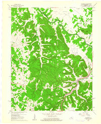
1960 Map of Colesburg
USGS Topo · Published 1961About this map
The Fort Knox Military Reservation dominates this landscape, covering a large portion of the upland territory where early settlement traces remain in the form of numerous family burial grounds like McMillen Cem and Cedar Creek Cem. The rugged terrain is defined by the winding Rolling Fork river, which marks the boundary between Bullitt and Hardin counties. In the lowlands, the Louisville and Nashville railroad and the Louisville and Nashville Turnpike run parallel to Clear Creek, connecting the community of Colesburg to the broader regional transport network.
Find a feature on this map
48 named features on this map. Tap any name to fly to it.
Don’t see what you’re looking for? This feature index may not catch every label — zoom into the map to look around manually.
Map Details
Editions of this 1960 Colesburg Map
3 editions found
Other maps of this area

1935 · Elizabethtown
USGS Topo · 1:48,000

1936 · Vine Grove
USGS Topo · 1:62,500

1938 · Elizabethtown
USGS Topo · 1:62,500

1943 · Vine Grove
USGS Topo · 1:62,500

1946 · Pitts Point
USGS Topo · 1:24,000

1946 · Fort Knox
USGS Topo · 1:24,000

1946 · Colesburg
USGS Topo · 1:24,000

1946 · Vine Grove
USGS Topo · 1:24,000

1946 · Vine Grove
USGS Topo · 1:62,500

1948 · Cecilia
USGS Topo · 1:24,000