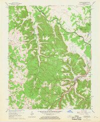
1960 Map of Colesburg
USGS Topo · Published 1969About this map
Fort Knox Military Reservation dominates much of the landscape in this 1960 revision, showing the extensive network of service roads and a Jeep Trail cutting through the wooded ridges. The topography is defined by the winding course of the Rolling Fork, which separates the military land from the agricultural Hays Flats. Near the river, the Woolridge Ferry Bridge stands as a key crossing point, while the Louisville and Nashville railroad tracks and the modern Kentucky Turnpike provide high-speed transit corridors through the valley.
Find a feature on this map
49 named features on this map. Tap any name to fly to it.
Don’t see what you’re looking for? This feature index may not catch every label — zoom into the map to look around manually.
Map Details
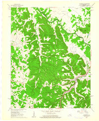
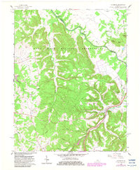
Editions of this 1960 Colesburg Map
3 editions found
Other maps of this area

1935 · Elizabethtown
USGS Topo · 1:48,000

1936 · Vine Grove
USGS Topo · 1:62,500

1938 · Elizabethtown
USGS Topo · 1:62,500

1943 · Vine Grove
USGS Topo · 1:62,500

1946 · Pitts Point
USGS Topo · 1:24,000

1946 · Fort Knox
USGS Topo · 1:24,000

1946 · Colesburg
USGS Topo · 1:24,000

1946 · Vine Grove
USGS Topo · 1:24,000

1946 · Vine Grove
USGS Topo · 1:62,500

1948 · Cecilia
USGS Topo · 1:24,000