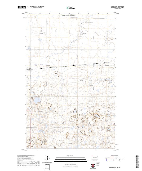
2024 Map of Colgan East
USGS Topo · Published 2024About this map
Colgan sits at the western edge of this prairie landscape, serving as a focal point in a region defined by its rigid grid of section lines and gravel roads. Located in the northern reaches of Divide County, the area is partitioned by a network of thoroughfares including 106th St NW and ND 5, which traverse a terrain dotted with seasonal wetlands and small basins. For those researching local heritage, the Zion Lutheran Cem stands as a significant landmark along 106th St NW, marking the site of early community gathering and burial. The map reveals the characteristic North Dakota pattern of large-scale agriculture, where the land is meticulously divided into townships such as t163n r99w and t164n r100w, reaching up to the international border with the United States of America.
Find a feature on this map
29 named features on this map. Tap any name to fly to it.
Don’t see what you’re looking for? This feature index may not catch every label — zoom into the map to look around manually.
Map Details
Editions of this 2024 Colgan East Map
This is the sole edition of this map. No revisions or reprints were ever made.
Other maps of this area

1948 · Crosby SW
USGS Topo · 1:24,000

1948 · Ambrose
USGS Topo · 1:24,000

1950 · Crosby
USGS Topo · 1:62,500

1953 · Williston
USGS Topo · 1:250,000

1957 · Williston
USGS Topo · 1:250,000

1983 · Colgan West
USGS Topo · 1:24,000

1983 · Alexandria
USGS Topo · 1:24,000
1983 · Colgan East
USGS Topo · 1:24,000
1983 · Colgan SE
USGS Topo · 1:24,000

1984 · Crosby
USGS Topo · 1:100,000