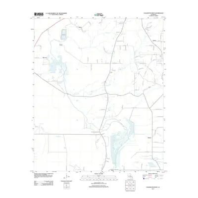
2012 Map of Collinston West
USGS Topo · Published 2012About this map
Staulkinghead Creek and Jordan Creek wind through this Louisiana landscape, defining the rural drainage patterns of Morehouse Parish in the early 21st century. The map highlights a series of small, dispersed communities like Spyker, Upland, and Marcarco, reflecting the low-density settlement characteristic of this region. Notable family and local history landmarks are preserved in the locations of the Pickett Cemetery, Howell Cemetery, and Carter Cemetery, which stand alongside agricultural infrastructure. A network of local routes, including Spyker Road and Levee Road, connects these small hubs across the alluvial plain. Further south, the Fairbanks Lookout Tower remains a prominent landmark near the community of Wham, while the intricate waterways of Stink Creek and Corney Slu suggest the complex wetland environment that shapes land use in this part of the state.
Find a feature on this map
77 named features on this map. Tap any name to fly to it.
Don’t see what you’re looking for? This feature index may not catch every label — zoom into the map to look around manually.
Map Details
Editions of this 2012 Collinston West Map
This is the sole edition of this map. No revisions or reprints were ever made.
Other maps of this area

1935 · Collinston
USGS Topo · 1:62,500

1935 · Naff
USGS Topo · 1:62,500

1935 · Drew
USGS Topo · 1:62,500

1935 · Haile
USGS Topo · 1:62,500

1955 · Jackson
USGS Topo · 1:250,000

1955 · Shreveport
USGS Topo · 1:250,000

1956 · Shreveport
USGS Topo · 1:250,000

1956 · Bastrop
USGS Topo · 1:62,500

1956 · Haile
USGS Topo · 1:62,500

1957 · Monroe North
USGS Topo · 1:62,500