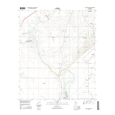
2015 Map of Collinston West
USGS Topo · Published 2015About this map
Morehouse Parish and Ouachita Parish meet in this landscape defined by the lowlands and waterways of northern Louisiana. The survey documents a network of rural settlements, ranging from Collinston and Upland in the east to Spyker in the north and the small community of Wham near the southern border. The terrain is crisscrossed by numerous drainage systems including Staulkinghead Cr, Jordan Cr, and Sandlick Bayou, reflecting the intricate hydrology of the region before significant modern development altered these patterns.
Find a feature on this map
61 named features on this map. Tap any name to fly to it.
Don’t see what you’re looking for? This feature index may not catch every label — zoom into the map to look around manually.
Map Details
Editions of this 2015 Collinston West Map
This is the sole edition of this map. No revisions or reprints were ever made.
Other maps of this area

1935 · Collinston
USGS Topo · 1:62,500

1935 · Naff
USGS Topo · 1:62,500

1935 · Drew
USGS Topo · 1:62,500

1935 · Haile
USGS Topo · 1:62,500

1955 · Jackson
USGS Topo · 1:250,000

1955 · Shreveport
USGS Topo · 1:250,000

1956 · Shreveport
USGS Topo · 1:250,000

1956 · Bastrop
USGS Topo · 1:62,500

1956 · Haile
USGS Topo · 1:62,500

1957 · Monroe North
USGS Topo · 1:62,500